
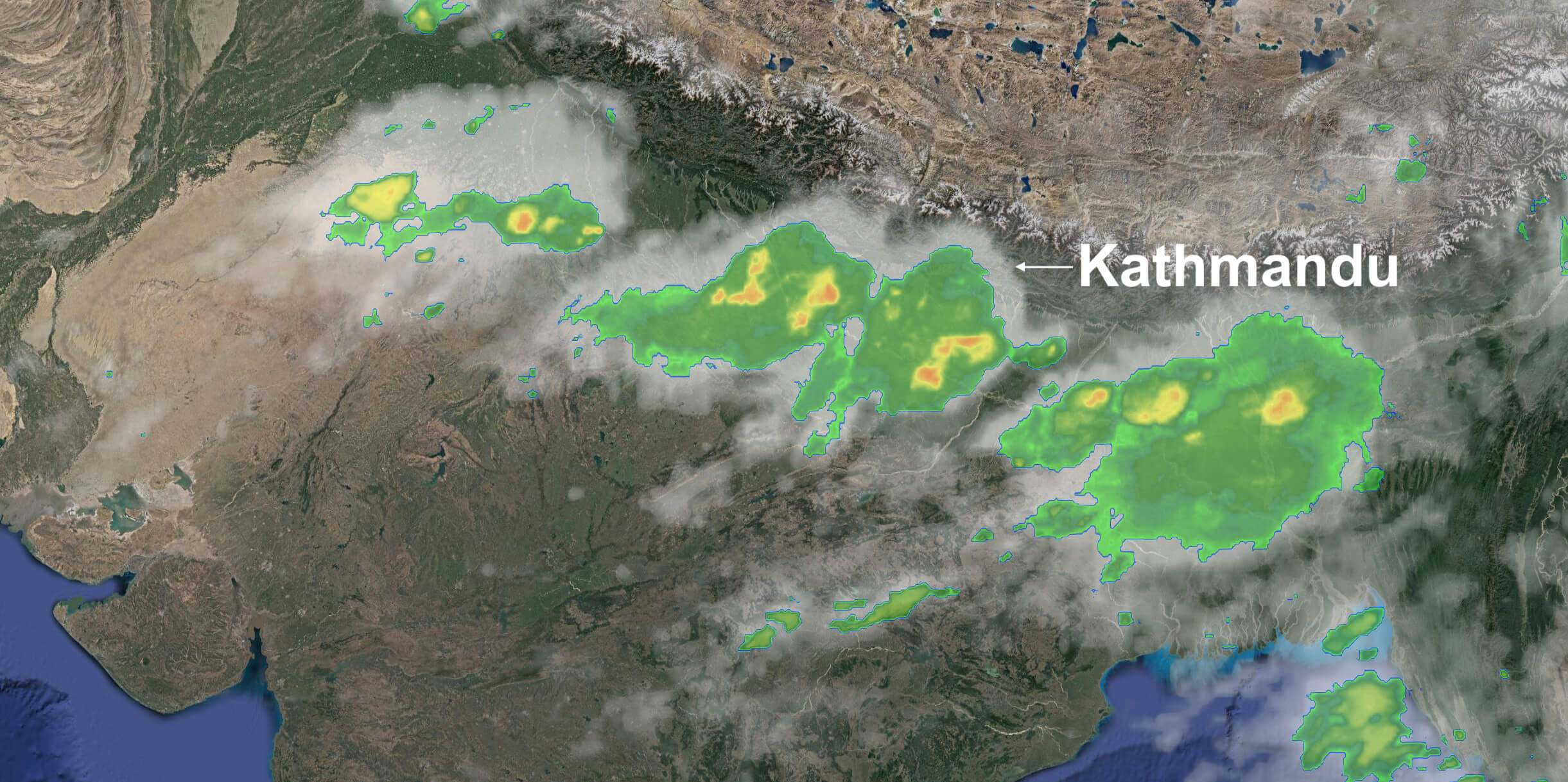
The Department of Meteorology and Hydrology has forecast more heavy rains this week, as a new monsoon pulse moves east to west across Nepal. The central mid-mountains and Tarai, already battered by deadly landslides last week is already feeling the brunt of this new system with Kapilvastu getting more than 50mm of rain overnight. The department has issued a warning on the Bandganga River, which is already flowing above the danger mark. The smaller rivers in the region are already swollen and are moving down across the border to India. More than a 100 people have been either killed or are missing in the rains last week in Nepal. The department has said the monsoonal trough will move slowly across the country and will last till at least Friday 24 July.
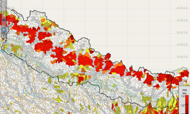
"We have already informed local governments about the risk of landslides and floods, but we advise all individuals and households to take their own precaution and even relocate to the homes of relatives and friends for the time being if they live in high risk areas," Anil Pokhrel of the National Disaster Risk Reduction and Management Authority. He said the Authority and the Department had concluded that there was a high risk of water-induced disasters in the coming week. The Authority has also opened a hotline at 1149 and 1155 for queries about flood risk is said to be highest in Provinces 1,2 and 5, as well as Bagmati and Gandaki. It also said there might be heavy isolated rainfall in the far west of the country. It advised residents to keep away from small mountain streams and rivulets, avoid steep slopes, and keep away from the floodplains of rivers in the Tarai.