
Even in normal years Nepal has one of the highest fatality rates in the world from landslides and flashfloods. But even by that grim standard, 2020 has been particularly bad.
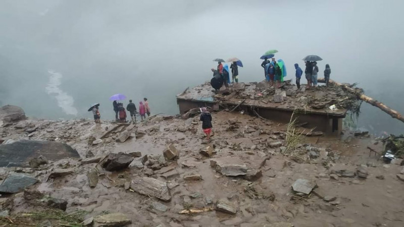
The latest landslide in Nepal’s Sindhupalchok district on 13 September took the total in the district in the past two months to 105, and the nationwide death toll this monsoon to 334 this monsoon. Photo: Bajir Singh Bhandari
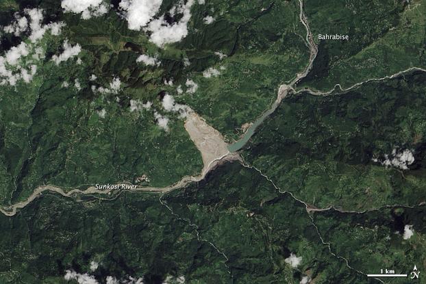
Disaster management experts were just totaling the number of fatalities in this deadly season, when news came on 13 September of yet another massive landslide in Sindhupalchok district 60km northeast of Kathmandu that may have cost 31 more lives.
This followed huge slips on 8 July and 14 August that had killed a total of 58 people in the same general area of Sindhupalchok near the Chinese border. The total 334 deaths from landslides in Nepal this year surpassed the total of 247 in 2014, of which 145 were killed in just one massive slide in Jure of the same district.
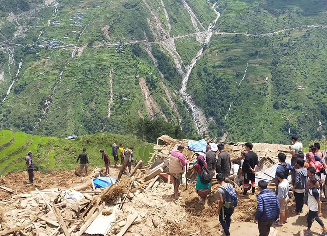
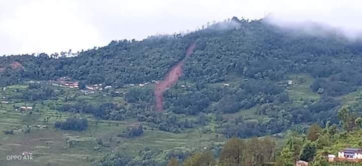
The Lidi landslide in Sindhupalchok on 13 August shows how road building on fragile slopes already made unstable by the 2015 earthquakes compounded the disaster. Photo: RSS
The disasters this year has been compounded by the Covid-19 crisis, which had killed 360 people as of Tuesday. A heavier-than-usual pre-monsoon had already saturated the soil in the mountains of Nepal when the main rains arrived in July.
But what makes Sindhupalchok so prone to landslides and flash floods? Disaster management experts point to the after-effects of the two major 2015 earthquakes which killed 8,890 -- 40% of them in Sindhupalchok. They also blame the region’s fragile geology, as well as the haphazard digging of poorly-engineered rural roads that destabilise the slopes even further.
Five years later Sindhupalchok was still being rocked in Wednesday morning by 6M aftershock.
The flashflood on a river in Dhorpatan on the night of 2 September, swept away 38 people, only 14 bodies were recovered.
To be sure, other districts have also been badly hit this year. A flashflood in Dhorpatan municipality of Baglung district killed 14 people on 4 September, and there has been much loss of life in Myagdi, Tanahu, and Jajarkot after cloudbursts.
In a paper, geologist Basanta Raj Adhikari at the Institute of Engineering says that between 1972-2016 a total of 5,190 people lost their lives in 3,419 recorded landslide events – 490 of them in the past three years alone.
Relative to its population, Nepal has the highest fatality rate from landslides in the world. The country is one of the most-densely populated mountain regions in the world, and being the youngest mountain range, the Himalaya are inherently unstable as well as being battered by heavy monsoon rains from June to September.
“There is a lack of prioritisation and willingness to see the depth of this problem,” says Adhikari. “We found that rainfall-triggered landslides are more than twice as likely to occur within 100m of a road, than landslides generated by earthquakes.”
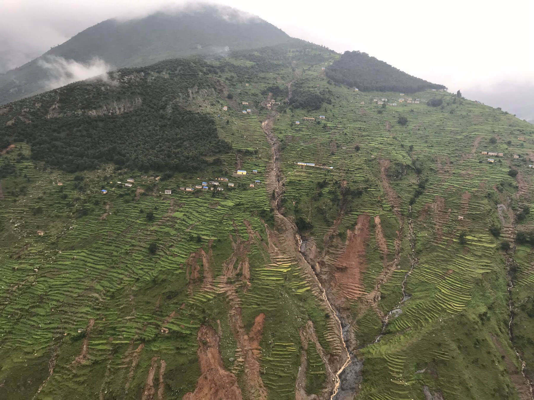
Nepal has built nearly 60,000km of rural roads in the past three decades, and the alignments of most of them are determined by local politicians, and not designed by engineers. They are also poorly maintained, and do not have proper drainage.
‘In tectonically active mountains such as the Himalayas, natural landslides play a fundamental role in the evolution of the landscape. But there is a clear anthropogenic influence in the occurrence of landslides in Nepal,’ writes David Petley, a professor at the University of Sheffield in the UK, and a global expert on landslides.
VISIBLE FROM SPACE: The Bhote Kosi landslide in an image taken in 13 September 2013 shows smaller precursor landslips, and one taken on 18 September 2014 shows the size of the slide and the impounded lake on the Bhote Kosi. Photos: NASA
In 2017, Nepal imported 12,712 excavators, bulldozers and cranes, a 30% increase from the previous year. One of the importers, MAW Earthmovers, sold the most JCB equipment in South Asia in Nepal, and the second-highest amount globally.
Anil Pokhrel, who heads the recently established National Disaster Risk Reduction Management Authority (NDRRMA) under the Ministry of Home Affairs, has been flying around the country with top politicians handing out relief packages to landslide victims. He says: “Everywhere we visited, local leaders blamed haphazard road construction for endangering their lives, but there is pressure from the communities themselves for road access.”
There is also evidence that many local leaders are themselves contractors and own heavy earth-moving equipment which they are keen to rent out to themselves. These poorly built roads are often triggers for landslides.
Watershed expert Madhukar Upadhya says: “It is not local individuals putting pressure to build roads, it is mostly a nexus between local leaders and contractors.”
Geologists say that many villages in Nepal’s mountains are located along the path of old landslides, but people tend to forget quickly and start to grow crops on the debris field and soon new settlements rise on high-risk slopes.
Recent landslides also show that many villagers get a false sense of security from the belief that planting trees above the village will protect them from landslides. While community forests have benefits, they are not a panacea.
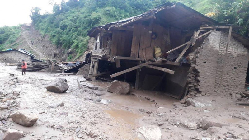
Forest cover does not necessarily prevent landslides as this photograph of Durlung of Parbat district in June shows. Nine people were killed in the disaster.
“Heavy monsoon downpours cause mass failure of inherently unstable slopes on a large scale and at depths far below the root zone of trees,” says Upadhyay. “Forest cover, while desirable, plays little or no role in stopping such mass wasting. We covered slopes with forests but forgot about soil management, leading to more destructive landslides.”
Indeed, photographs of many of the landslides this year show deep scars that start in forested slopes tumbling down to settlements below. In Durlung village of Parbat district, it was a densely forested slope that failed in June and swept away a settlement killing nine people. Forests also did not protect Jajarkot villages from monsoon cloudbursts.
“Nobody would imagine that such a heavily-forested slope could have failed, we should remove this deeply-rooted belief and put other appropriate measures to control landslides,” said Pokhrel, who visited the area after the event.
Landslide early warning systems (LEWS) do exist, and have saved lives in pilot projects in Nepal before. The solar-powered equipment can measure land deformation, soil moisture content on slopes and trigger a siren after it crosses a threshold.
“This is not rocket science,” says Adhikari. “It can be installed easily, and it will not cost more than a minister’s chopper visit after each of these landslides.”
Landslides scar a slope in Jajarkot after a cloudburst in July. Twelve people were killed.
More than 90% of landslides in Nepal occur during the monsoon between June and September, peaking in July and August. Several studies suggest the climate change is causing freak storms and more frequent cloudbursts in the Himalaya, increasing the vulnerability of people who live in the mountains.
A version of this report appeared in thethirdpole.net.